Understanding Houston Storms: The Stealthy Threat of Rain-Wrapped Tornadoes & Destructive Winds
Houston, a sprawling metropolis known for its vibrant culture and economic dynamism, also sits in a region prone to severe weather. While hurricanes often dominate the headlines, residents of Southeast Texas are no strangers to intense thunderstorms that can unleash a different kind of fury: rain-wrapped tornadoes and powerful straight-line winds. Understanding these unique meteorological phenomena is crucial for safeguarding lives and property in the Houston area, where quick reactions can make all the difference.
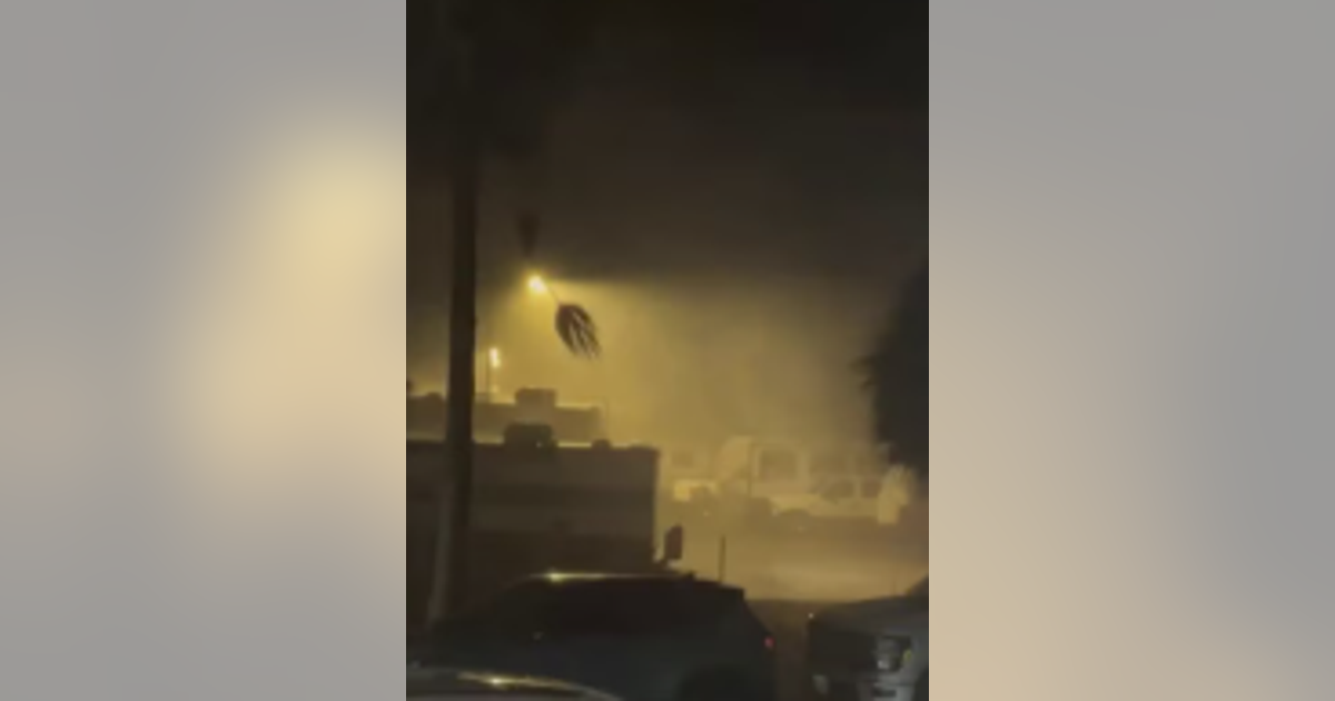
Unlike the dramatic, easily visible funnels often seen in media, many tornadoes in Houston and surrounding areas present a stealthier, more insidious threat. These are often embedded within larger storm complexes, shrouded in heavy rain, making them incredibly difficult to spot, even in broad daylight. This article delves into the specifics of these rain-wrapped twisters, the equally dangerous wind threats, and how Houstonians can best prepare for and react to severe weather.
The Elusive Threat: Rain-Wrapped Tornadoes in Houston
When most people envision a tornado, they picture a distinct, narrow funnel cloud descending from a dark sky. However, the reality for many Tornado Houston events is far less discernible. Rain-wrapped tornadoes are just as their name suggests: concealed within a deluge of precipitation, making them visually obscured until they are dangerously close, or even directly overhead.
These types of tornadoes typically form within strong lines of thunderstorms, often referred to as a Mesoscale Convective System (MCS) or a squall line. The very same storm cells that produce torrential downpours and lightning can also generate intense rotation. As these storms move through urban corridors like downtown Houston or its western and eastern suburbs, the embedded tornadoes, though often short-lived and generally not reaching the extreme EF2+ strengths of their more visually striking counterparts, pose a significant risk. Their hidden nature means there's often no visual cue to warn of their presence, demanding an immediate response to official warnings rather than relying on sight.
The danger is amplified by the sheer speed at which these storm systems can propagate. Models often predict their movement, but the cold pool advancing from these complexes can accelerate their pace, bringing threats to communities faster than anticipated. This makes staying inside during periods of heavy rain, especially when a tornado watch is in effect, an paramount safety measure.
More Than Twisters: The Widespread Danger of Straight-Line Winds and Hail
While the threat of a Tornado Houston rightly commands attention, it's essential not to underestimate the destructive potential of other severe weather phenomena frequently accompanying these storms: straight-line winds and hail.
Straight-line winds are powerful gusts of wind that rush outwards from a thunderstorm's downdraft, pushing everything in their path in one general direction. These winds can frequently reach speeds of 60-70 mph, and sometimes even higher, causing damage often mistaken for a weak tornado. They can fell trees, snap utility poles, tear off roofs, and overturn vehicles over a wide area, making them a more widespread threat than a localized tornado. The extensive damage they inflict can lead to significant power outages and pose a serious risk to anyone caught outdoors.
Hail is another common and damaging component of Houston's severe thunderstorms. Generated by powerful updrafts carrying raindrops high into extremely cold parts of the storm, these ice pellets can grow to significant sizes before falling to earth. Quarter-sized hail, a frequent occurrence during stronger storms, can cause substantial damage to vehicles, crack windshields, and dent siding and roofs on homes. Larger hail can even pose a direct physical threat to people and pets caught outside.
For Houston residents, preparing for severe weather means not just bracing for a potential tornado but also understanding the very real and pervasive dangers of these non-tornadic wind and hail events. The combined assault of heavy rain, strong winds, and hail can turn a routine afternoon into a hazardous situation, underscoring the need for comprehensive preparedness.
The Science Behind the Fury: How Tornadoes Form in Southeast Texas
Tornadoes, whether rain-wrapped or visible, are products of specific atmospheric conditions, often born from the most violent thunderstorms known as supercells. These powerful, long-lived storms are characterized by a deep, persistent rotating updraft called a mesocyclone, which is the engine for tornado development.
The process begins with horizontal wind shear – differences in wind speed and direction at various altitudes. This shear creates a horizontal rotation in the atmosphere. When a strong updraft within a thunderstorm encounters this rotating air, it can tilt the horizontal rotation vertically. As this vertical column of air stretches and intensifies, its rotation speeds up, much like a figure skater pulling their arms in during a spin. If this rapidly swirling column extends down to the ground, a tornado is born.
In Southeast Texas, the interaction of warm, moist air from the Gulf of Mexico with cooler, drier air masses, coupled with varying wind profiles, often provides the "moderate atmospheric instability" mentioned in weather reports. This instability acts as fuel, allowing storm cells to strengthen rapidly as they push eastward across the region. While a widespread tornado outbreak isn't always expected, these conditions are ripe for individual storms to produce short-lived but intense tornadoes, especially those shrouded in rain.
The most powerful tornadoes, typically associated with supercells, can be incredibly destructive, featuring wind speeds over 250 mph, occasionally even reaching 300 mph. These monsters can carve damage paths over a mile wide and 50 miles long. While Tornado Houston events are typically not of this extreme magnitude, any tornado, regardless of its strength rating, carries significant risk, especially in densely populated areas.
Proactive Preparedness: Essential Tornado Safety for Houstonians
Being prepared is the most critical step in mitigating the risks associated with severe weather in Houston. The Houston Office of Emergency Management (OEM) and other local officials consistently stress the importance of understanding the threat and having a plan.
- Know the Signs of a Tornado: Beyond a visible funnel, indicators include a dark, often greenish sky, a wall cloud (a lowered area of the storm base), large hail, and a roaring sound similar to a freight train. With rain-wrapped tornadoes, the roaring sound might be your first and only auditory warning.
- Stay Informed with Official Weather Reports: Do not rely solely on social media. Tune into local news, use NOAA Weather Radio, and register for emergency alerts from city and county officials. Many local weather apps also provide real-time updates and warnings based on your location.
- Identify and Practice Going to a Safe Location: This is paramount. For most Houston homes without basements, the safest place is a small, interior, windowless room on the lowest level of your home. Think bathrooms, closets, or interior hallways. Stay away from windows and exterior walls. If you're in a mobile home or vehicle, seek a sturdy shelter nearby. Practice this drill with your family regularly so everyone knows exactly what to do when a warning is issued. For more detailed guidance on securing your home and identifying your safest spot, refer to our comprehensive guide: Houston Tornado Safety: Essential Prep & Identifying Your Safe Spot.
- Prepare an Emergency Kit: Have a readily accessible kit with essential supplies, including water, non-perishable food, a battery-powered or hand-crank flashlight, extra batteries, a first-aid kit, medicines, and important documents.
Navigating Alerts: Tornado Watch vs. Tornado Warning
Understanding the difference between a tornado watch and a tornado warning is vital for effective response:
- Tornado Watch: This means conditions are favorable for tornadoes to develop in and near the watch area. This is the time to review your safety plan, check on vulnerable family members or neighbors, charge your electronic devices, and stay tuned to official weather sources. A watch typically covers a larger geographical area and can last for several hours. When you hear about a Houston Tornado Watch, it's your signal to be vigilant and prepared to act.
- Tornado Warning: This is issued when a tornado has been sighted or indicated by weather radar, posing an imminent threat to life and property. A warning means DANGER IS IMMINENT. You must seek shelter immediately. Warnings are typically for smaller, more specific areas and are short-term, lasting only minutes. With rain-wrapped tornadoes, a warning is your most critical indicator to seek immediate shelter, as you may not have a visual cue.
Houston's unique weather patterns, especially the prevalence of rain-wrapped tornadoes and powerful straight-line winds, demand a heightened sense of awareness and proactive preparedness from its residents. By understanding these threats, staying informed through official channels, and knowing exactly how and where to take shelter, Houstonians can significantly reduce their risk and foster a more resilient community in the face of severe weather.